
398th Target: Ludwigshafen/Mannheim
probably early September 1944
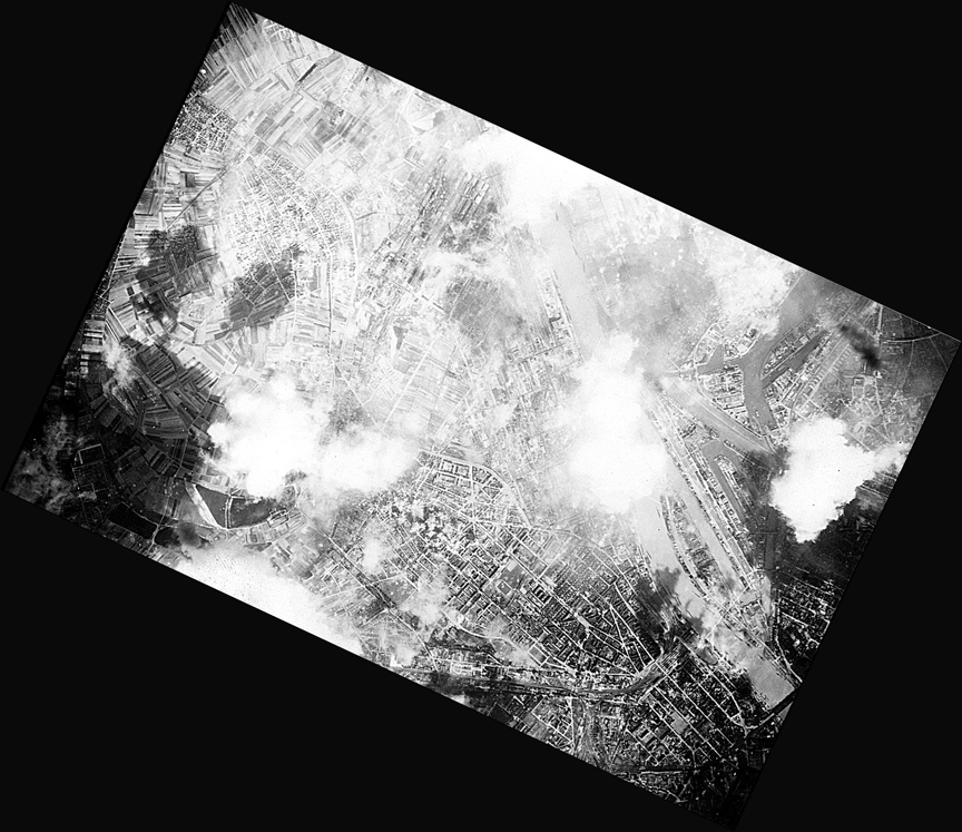
Below is a target photo for Ludwigshafen/Mannheim, Germany along with an analysis of how it was determined to be the Ludwigshafen/Mannheim area. There is light smoke/cloud cover; the smoke probably from bomb strikes in previous formations. Various bridges can be seen toward the bottom of the photo along with a network of canals.
These photos were obtained from the Edward C. Jordan 398th Photo CD.
Information about this photograph:
The Analysis: Scott initially suggested that the photo above (actually he started with the unrotated photo below) was Mannheim, Germany. He offered a current Google Map, Google Satellite Map, 1888 Mannheim map and a rotated Target Map as above as evidence (links so that you can compare will be provided shortly). Dave Jordan concurred that it appeared a perfect match to Mannheim. This was truly exciting. A survey of 398th Missions Targets indicated that the 398th flew to Mannheim on September 9, 1944, January 20, 1945 and February 1, 1945. However, I had always thought it was one of my dad's missions since it was in his photo collection, and Dad had finished his missions on September 3, 1944 and flew back to the States on September 22. Only the September 9 was in a timeframe, Ed could have picked up the photo; however, he did not fly on the September 9th mission so it was probably something he picked up as a general souvenir from copies available from the 398th Nuthampstead Base photographer. Scott then began an effort to identify another target photo, then called Unknown Target 1, but now called 398th Target: Mannheim - probably early September 1944 by looking at Google Maps for all 398th September 1944 missions and before. See 398th Missions Targets. When he came to September 3, 5, and 8 he recognized that the target for those days, Ludwigshafen was just across the river (west side) from Mannheim and in fact in the photo above more of Ludwigshafen is showing than Mannheim. What a find! Photo dates were now narrowed to September 3, 5, 8 or 9 and included Ed's last mission on September 3, 1944. The 398th also flew to Ludwigshafen on May 27, but Ed did not. Thus our best guess, given that Ed Jordan would want a photo of the target area of his last mission is that the photo date was September 3, 1944, though the other September dates are possible. |
Let's See for Ourselves: I know you can't wait to compare the target to Ludwigshaven/Mannheim yourself. So here's how.
How Did He Do It?: I was very curious how Scott initially figured out is was Mannheim. In fact, it was extra hard since the initial photo, see the one below, was rotated upside down and what turned out to be south, pointed to the top of the page. Was he a National Geographic contest winner? Scott replied that he and the family enjoyed jig saw puzzles and one day over lunch break, he started by finding the Rhein River on Google Maps and just moved in a southerly direction until he found a city on the river that looked like the photo. Once he got to Mannheim, the combination of rivers and canals fit right onto the jig saw puzzle. What Else Can you See?: Are those clouds or explosions from the bombardment. At first I thought they were clouds, but the spacing and the purpose of the photo suggests they are smoke from explosions. Source Infomation:
|
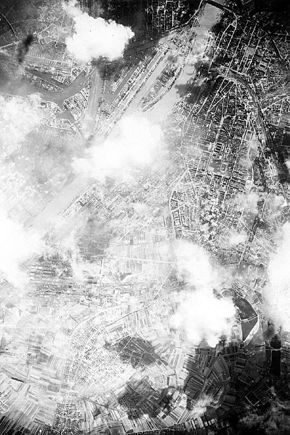
The above photo was the original orientation of the Unknown Target Photo, now identified as Ludwigshafen/Mannheim. This original photo was rotated 115 degrees clockwise to obtain the north pointing photo at the top of this page. |
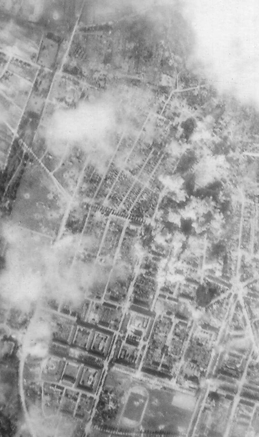
Scott expanded the view of a particular area of the Ludwigshafen, Germany landscape in the Target Photo. He was able to identify bomb craters, either from an earlier 8th Air Force mission or the one on the day the photo was taken. Note the park like area at the bottom of the photo. In the middle of the open area is an oval, perhaps soccer field, or a swimming pool, or perhaps something else. There are small craters within the oval and within the park. |